As you might've gathered from recent blogs, I recently spent some time in the lovely state of Tasmania over April and the first week of May. To end the trip on a truly spectacular note, I solo hiked the Overland Track in the Cradle Valley National Park.
Click here for a great map if you're a visual person like me and want to get an idea of the topography and route.
May falls into the track's shoulder of the booking season (1st October to 31st May) requiring payment to walk the track, and walking is only allowed from North (Cradle Mountain) to South (Lake St Clair).
Track Stats:
Basic track distance - 65km
Average daily distance with side tracks - 12km
Pack weight - 18kgs
Trip duration - 6-7 days (though I did it in 4 because many side trips were not safe or worthwhile due to weather)
Track surface - 60% natural surface (rock, gravel, tree root, mud) and 40% boardwalk
Temperature range - daily max 18 degrees, nightly min - 6
8000 people walk the track each year
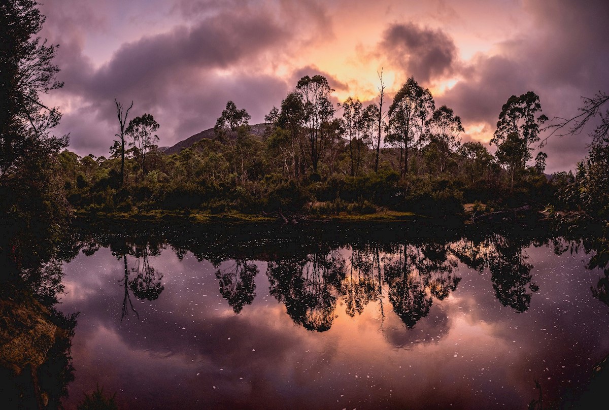
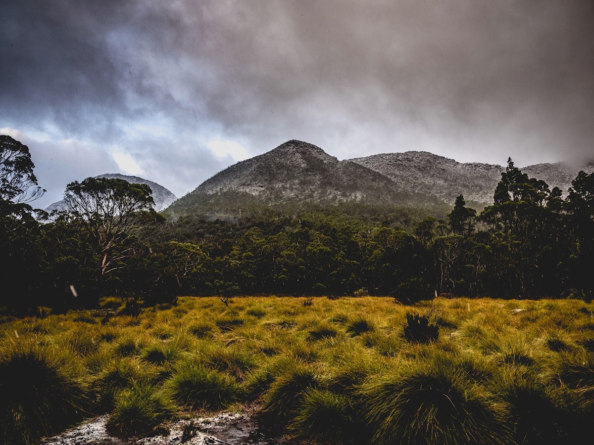
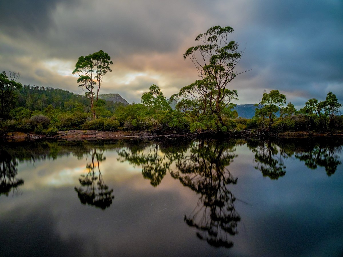
The area is famous for changeable and sometimes extreme weather, but never more so than in this season. I feel like I saw every mood of the park:
Day 1 and 2 had beautiful blue skies, Day 3 was torrential rain, Day 4 was snow, and Day 5 was moody and overcast.
It made for a very diverse walking experience, and I loved seeing how the landscape morphed with the weather.
Read on to hear about details from each day, and see some of my favorite images.
The Details: Daily Walking Diary
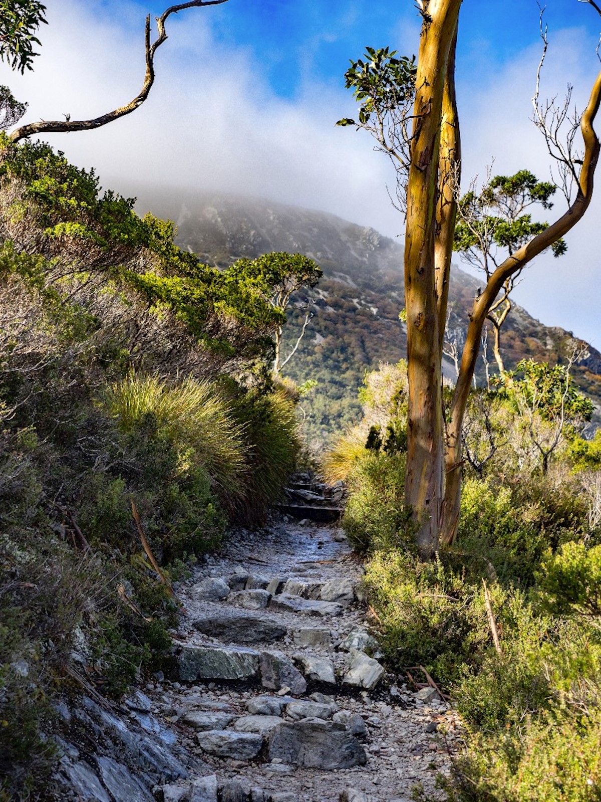
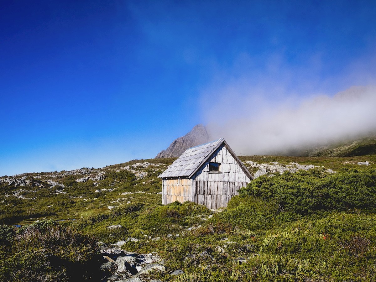
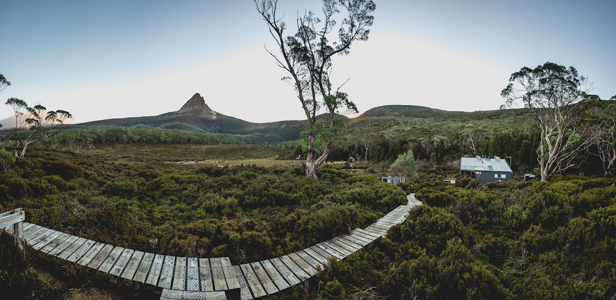
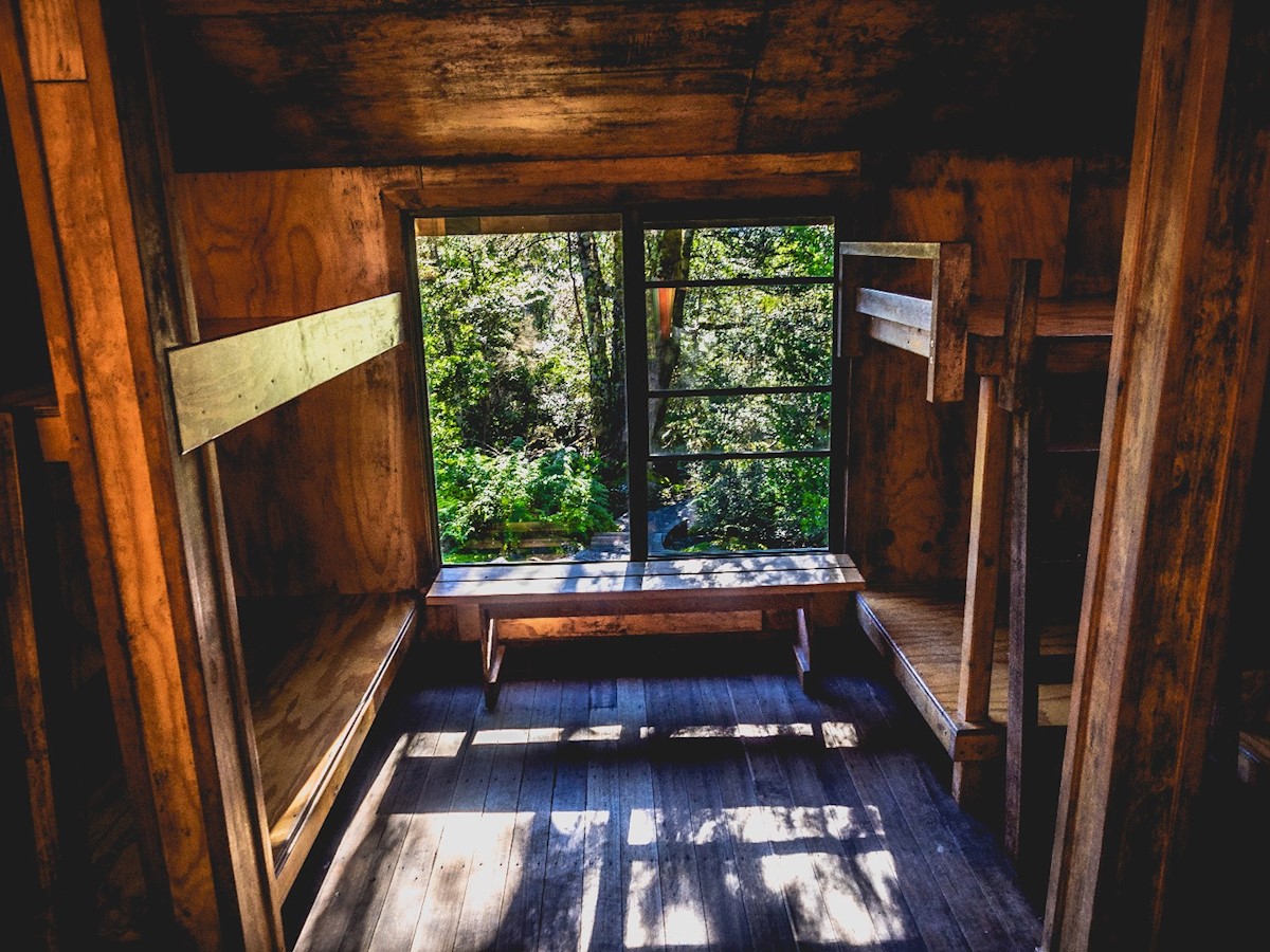
Day 1 (Cradle Mountain to Waterfall Valley)
Distance: 10.7 km
Time: 4-6 hours
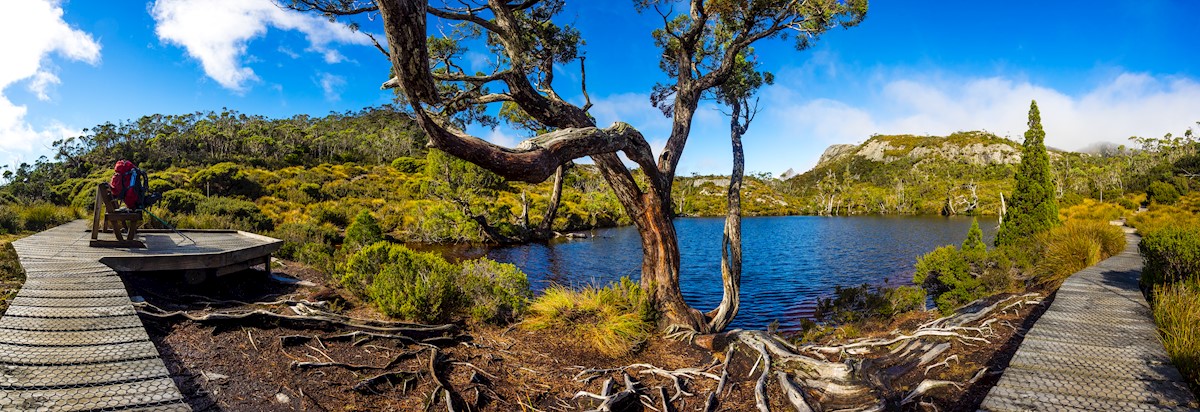
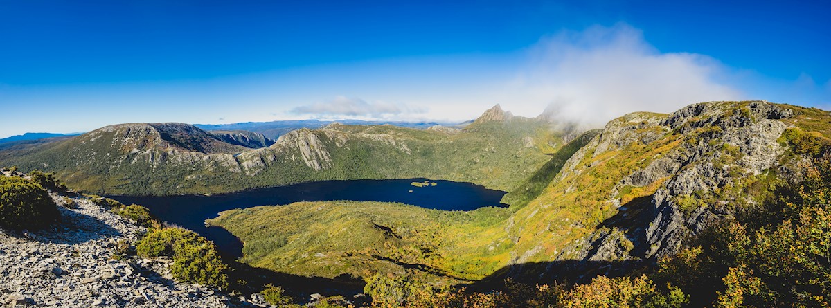
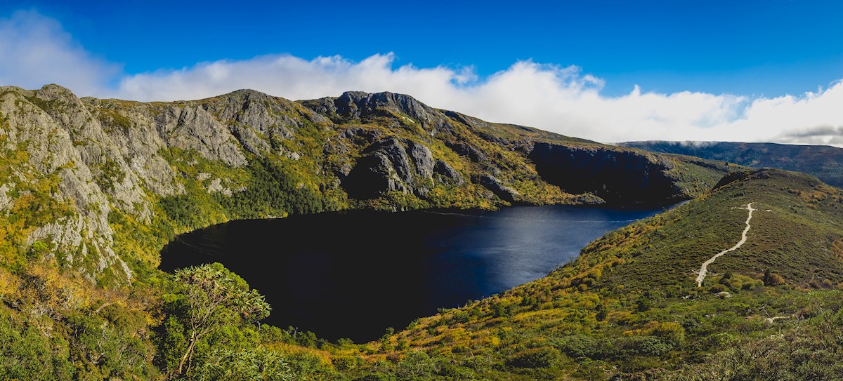
Terrain: Gradual ascent to Crater Lake (see above image) building into a very steep, short ascent to Marion's Lookout, followed by duckboard track over undulating alpine plains and button-grass fields, then a final descent into Waterfall Valley.
The first day is generally regarded as the most difficult, due to the steep climb up to Marion's Lookout in the morning - I mean just LOOK at this elevation profile - particularly given that your pack is at its heaviest (the only time I have ever, albeit briefly, regretted having so much food). There are chains to help you for the very steepest section of rock scrambling up to the peak, and lunch at the top tasted *amazing*.
The afternoon is a breeze in comparison, made all the sweeter by sweeping views of alpine landscapes. I started too late in the day to be able to complete one of the optional side trips up either Cradle Mountain peak (1545m - track departing from Kitchen Hut, pictured in the top left grid below), or Barn Bluff (1559m). Both are graded for experienced hikers only, as the path is at times precarious, and required 3-4 hours return to do safely.
I learned later from one of the rangers that while I was on the track there was a search and rescue conducted because a group of three had ascended Cradle Mountain too late in the day and got lost trying to make it to the first hut after dark, split up (for reasons I cannot fathom), and the last individual to be recovered was found hypothermic at 2 a.m. way off the track. It's just one of a plethora of stories that the amazing rangers can tell that exemplify how dangerous it can be to walk without 1. preparation, 2. common sense, and 3. adequate safety measures.
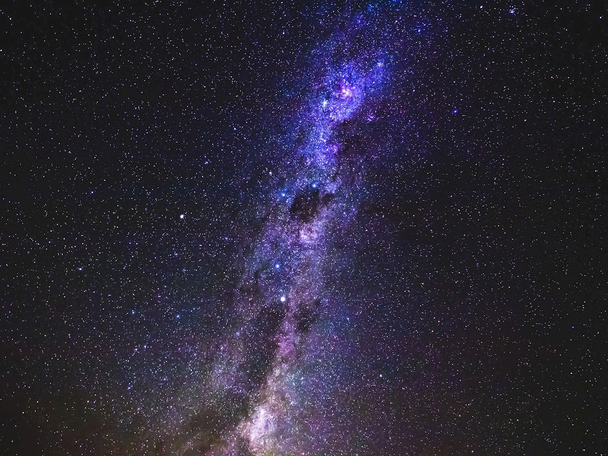
The night was crystal clear, and allowed an unrivaled view of the Milky Way - all the brighter for being so far away from the light pollution of the cities. A stargazer's paradise. I grabbed my sleeping bag and lay out on the helipad just away from the hut, and watched innumerable shooting stars sail across the night sky.
Turns out that during that time, a leach wormed its way into my sleeping bag, which I found later that night latched on between my toes and making a bloody mess in my sock as I was drifting off to sleep. Not the most lovely feeling. I was very leach conscious for the remainder of the trip!
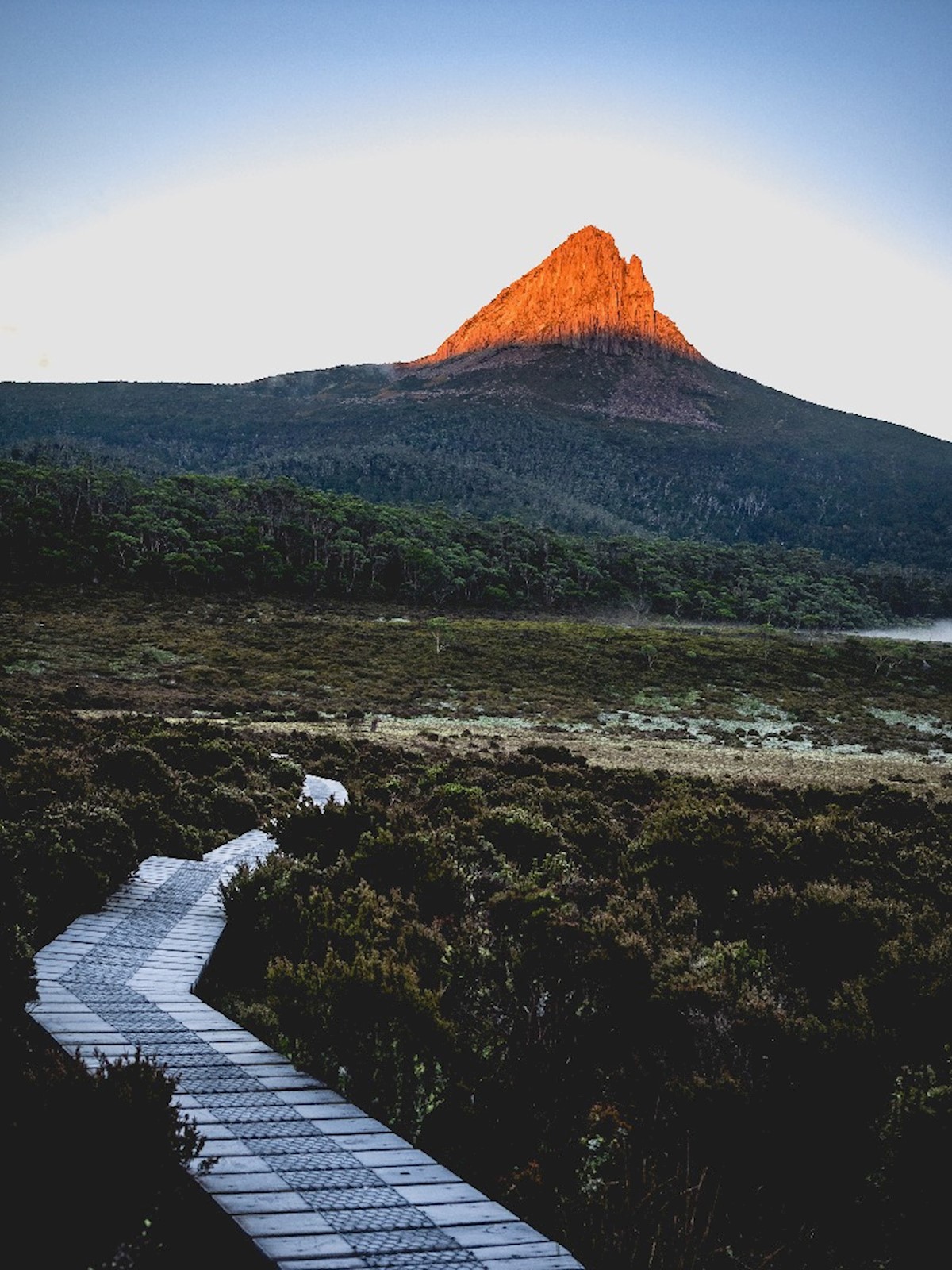
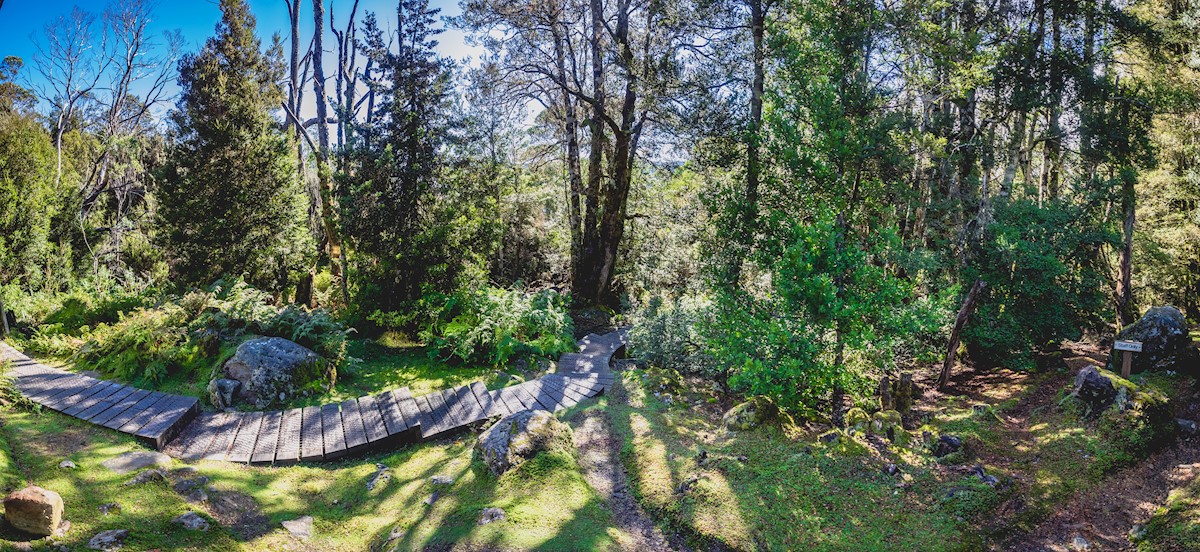
Day 2: Waterfall Valley to Windermere Hut
Distance: 7.8km
Time: 2.5-3.5 hours
Terrain: Undulating over the buttongrass plains, heathlands, alpine lakes and tarns.
Track Surface: Natural surface (rock, gravel), planking, duckboard and cordwood.
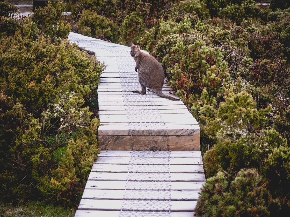
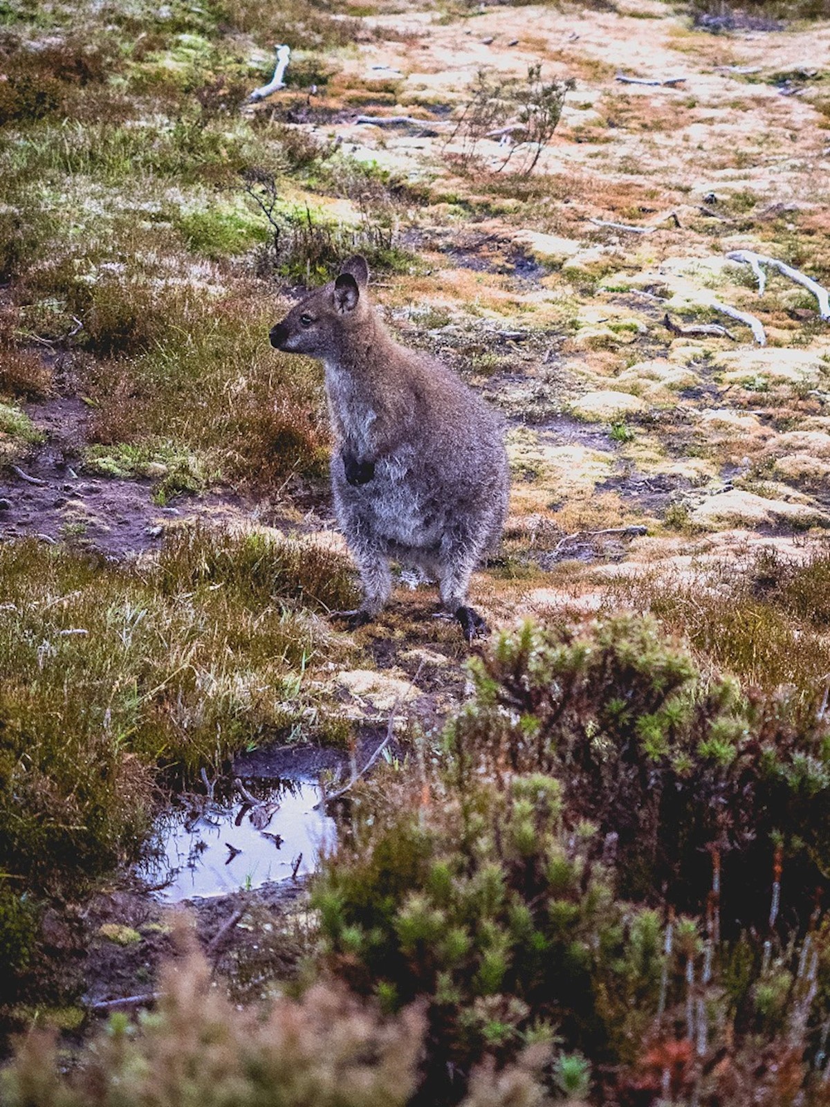
I woke up to the spectacular view of the rising sun illuminating Barn Bluff's peak bright orange, and the boardwalks frosted over after a chilly night. I also met my first Pademelon (see above), which look to me like larger, fatter, less cool quokkas - but maybe that's just my west-coast pride emerging.
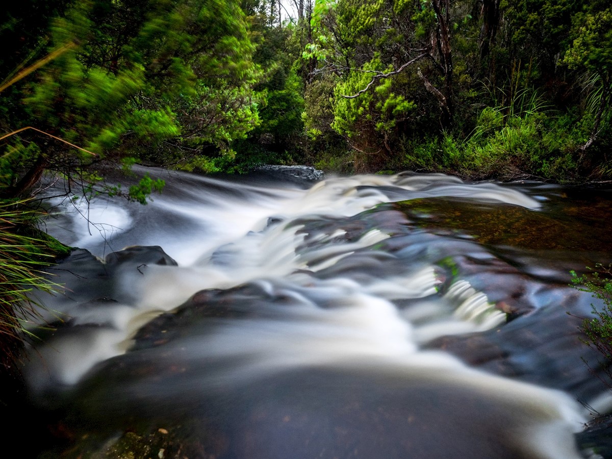
The walk to Lake Windermere is relatively flat and leisurely through heathland and alpine gums, with the sounds of waterfalls and bubbling streams never far off. The Lake Will side-trip is a popular choice, with people lunching on the banks of the lake with Barn Bluff for a backdrop, but as I was expecting to push through a hut I decided to keep walking along the main track.
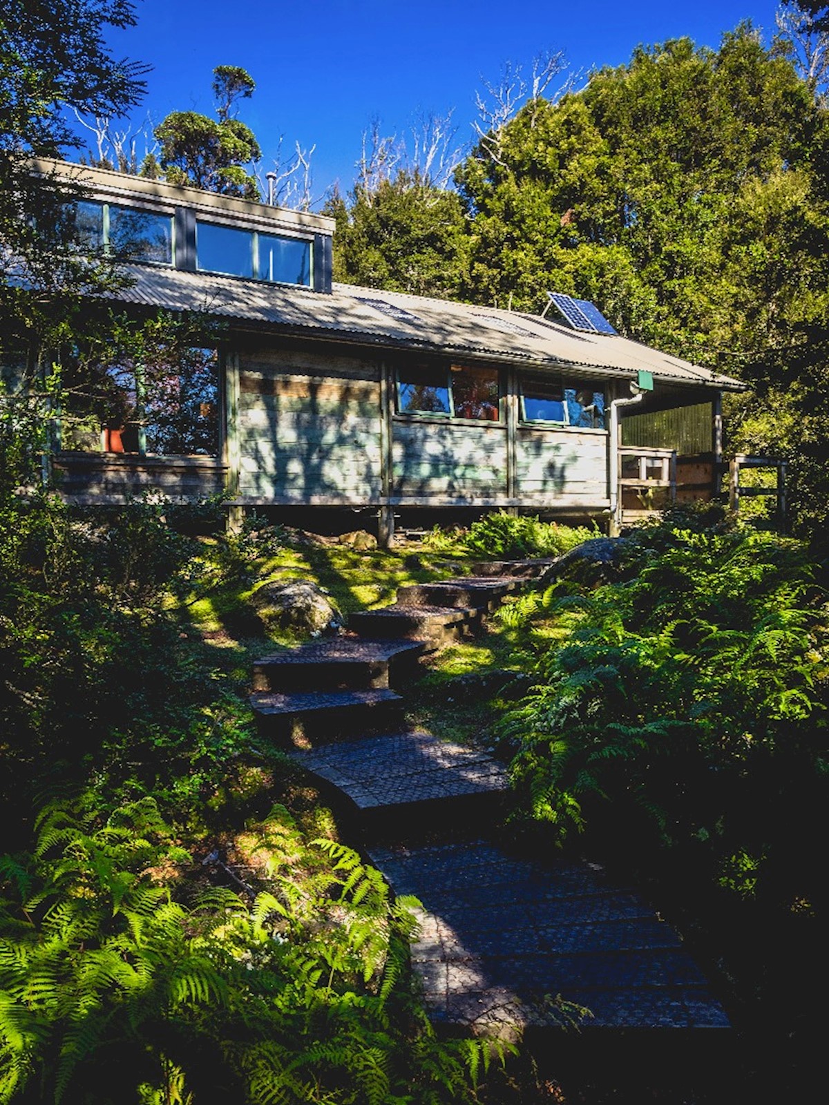
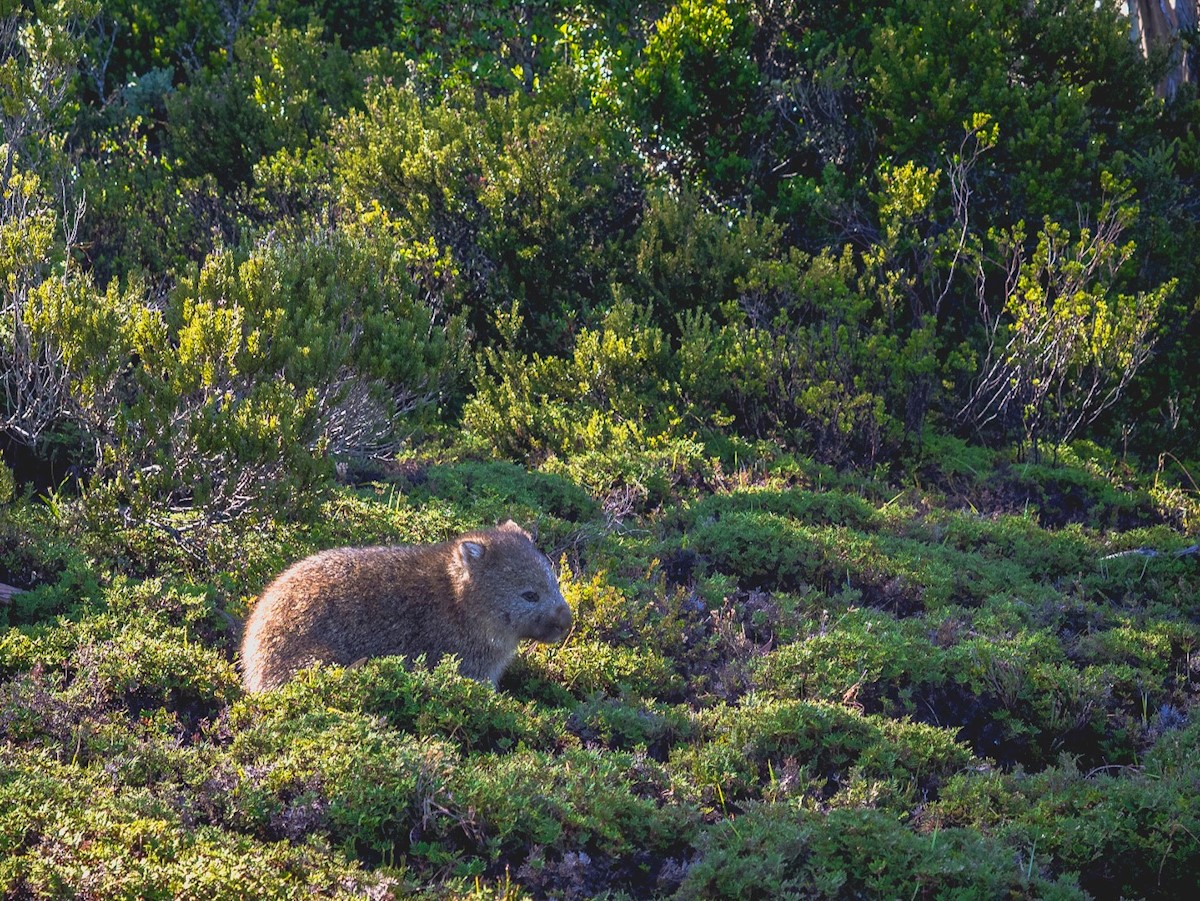
Windermere Hut is just beyond the lake, nestled in a fairytale myrtle forest. AND THERE WAS A WOMBAT THERE.
Lake Windermere to New Pelion Hut
Distance 16.8km
Time 5-7 hours
Terrain Undulating across the buttongrass plains, with some steep forested sections and mud (the guide left that last bit out).
Track Surface Mainly natural gravel surface with some planking and cordwood.
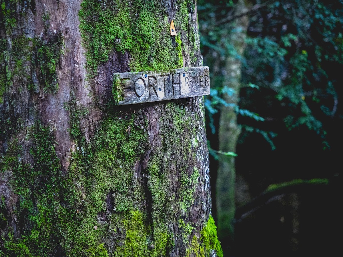
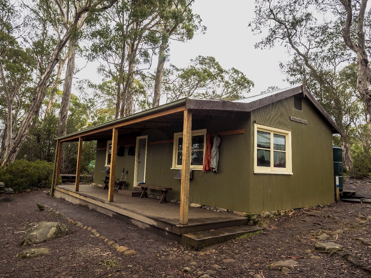
Usually this is a walker's third (and longest) day, however there was rain forecast for my 3rd day, and I didn't want to walk a long day on predominantly natural (read muddy) terrain in the rain, so I pushed though the 25 km day. This ended up being a really great decision, though I really had to push to make it before the early sunsets at this time of year. I was prepared to camp at Frog Flats (the lowest section of the track at 730m) if it didn't look like I'd make it in time, though I wasn't super keen on the notion as my guidebook described it as a 'leach-loved glade' and my relationship with leaches was strained after the first night's incident. Luckily that wasn't needed, so I could enjoy the day walking though mossy forest and crossing the Forth River, making it into New Pelion right in time to see the setting sun throw the dolomite Oakleigh Range into silhouette.
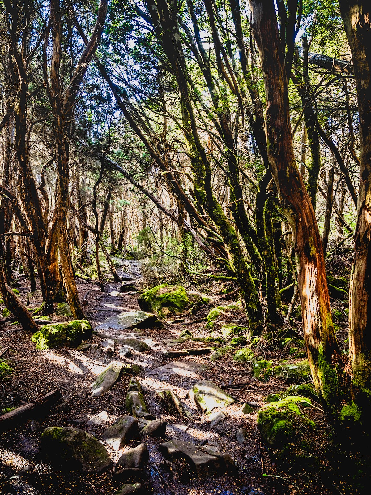
Day 3: New Pelion to Kia Ora
Distance 8.6km
Time 3-4 hours
Terrain Ascent through wet forest to Pelion Gap, followed by a gradual descent across buttongrass plains and through eucalypt forest to Kia Ora.
Track Surface Mainly natural surface (tree roots, muddy, rocky).
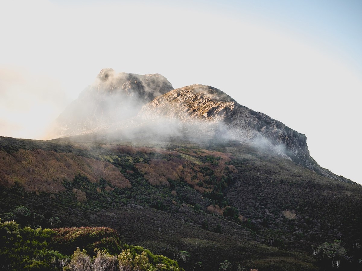
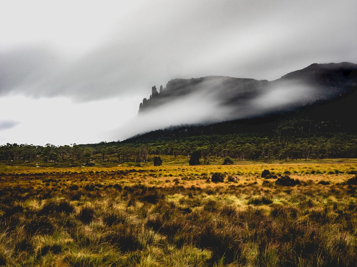
I woke up to a wet morning, as the forecast had promised, and started out on the track thankful that it was a short walking day. After a few hours, I emerged from the forest onto Pelion Gap – an exposed alpine plateau between Mt Pelion East and Mt Ossa that was shrouded in mist. Many choose to summit Mt Ossa, Tasmania's highest mountain, however there isn't much point if it's cloudy/misty as there'll be no view, and it's notoriously dangerous in wet conditions. These things considered, I decided to truck along on the main track. After arriving at around lunch time at Kia Ora, I left my pack at the hut and took a wander to the delightful Kia Ora creek, then settled in for the afternoon and evening.
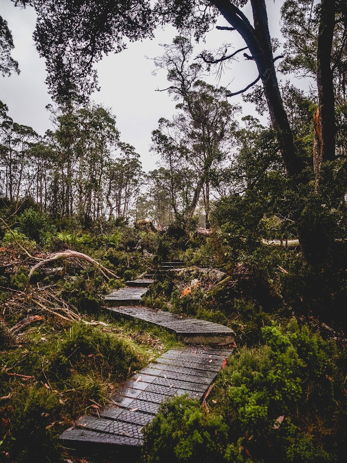
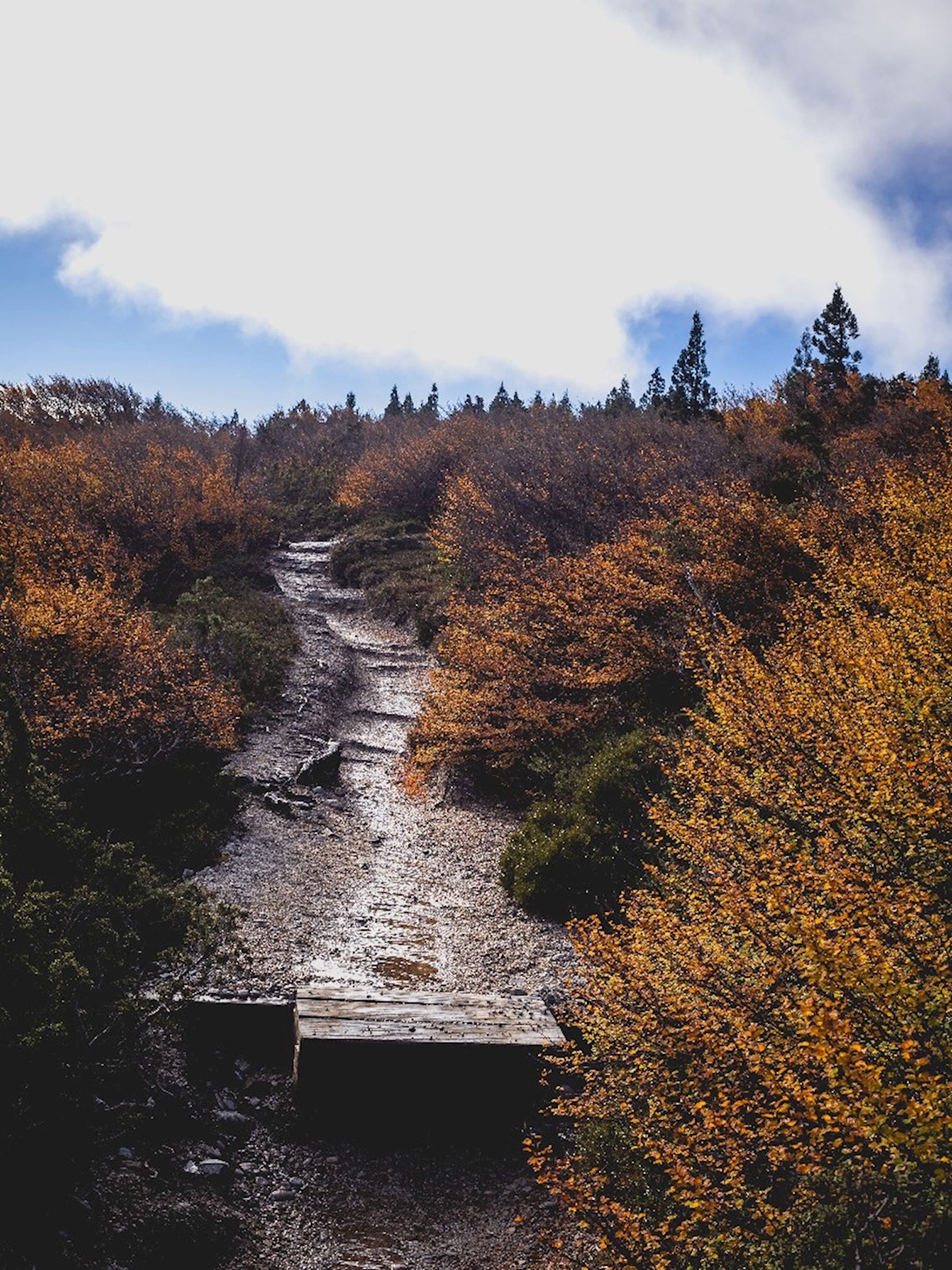
Day 4 Kia Ora to Windy Ridge
Distance 9.6km
Time 3.5-4.5 hours
Terrain Undulating, with gradual ascent and descent over Du Cane Gap. Mainly rainforest walking.
Track Surface Almost entirely natural surface (with tree root, gravel, rock or mud base), with some small amounts of cordwood and duckboard.
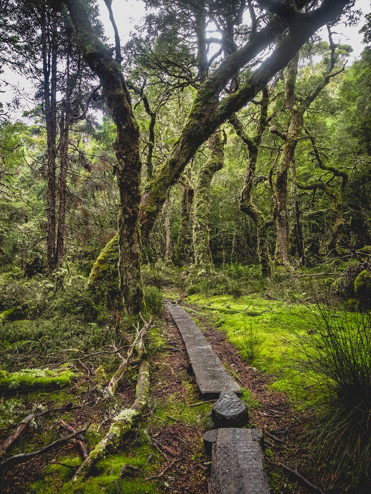
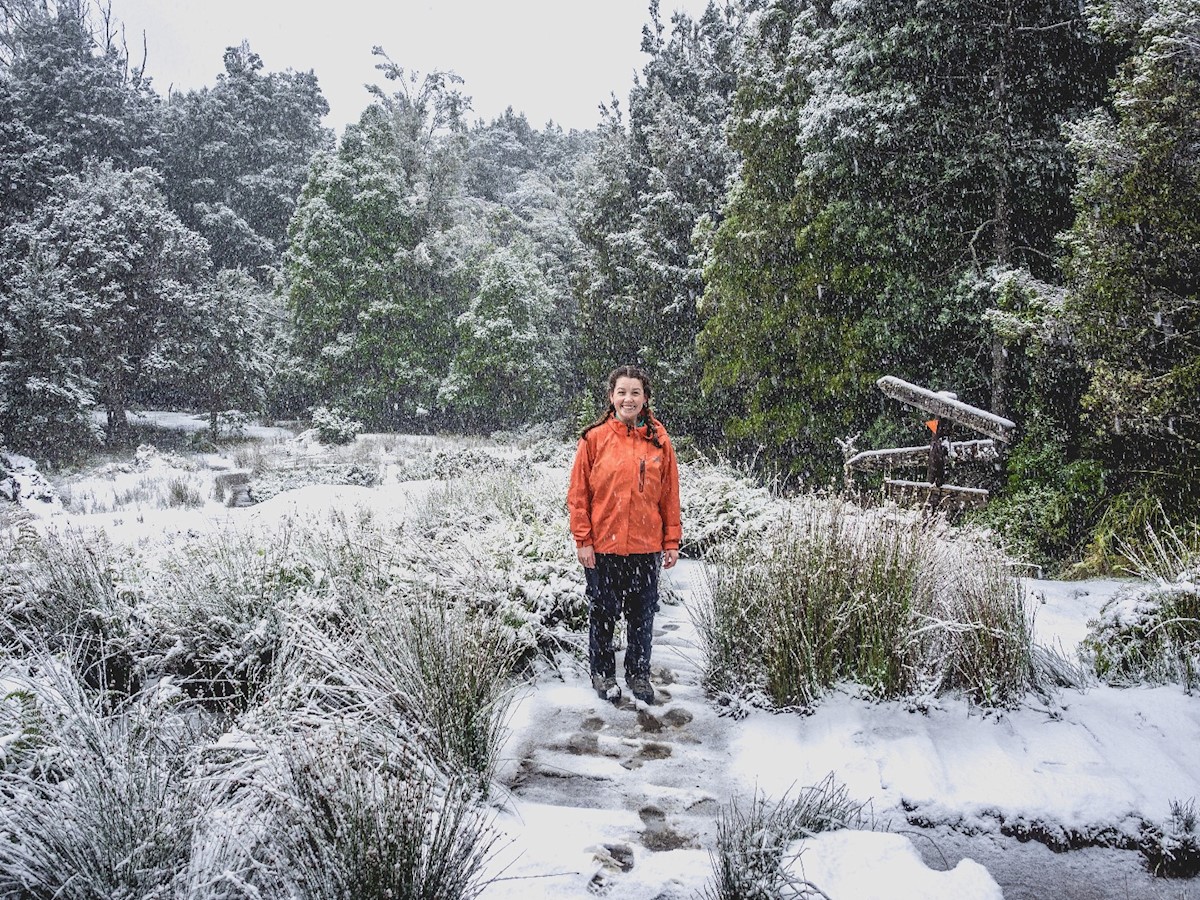
This was the morning of rainforest, waterfalls, and snow. Let me tell you, it's a weird feeling to see snow in a rainforest, but Tasmania is full of surprises. I woke to a light sprinkling of powder on the fields surrounding Kia Ora hut, and could see snow from over the night settled on the mountains. The morning's walk was beautiful beyond words, with towering gums erupting from banks of snow and the blue sky emerging occasionally.
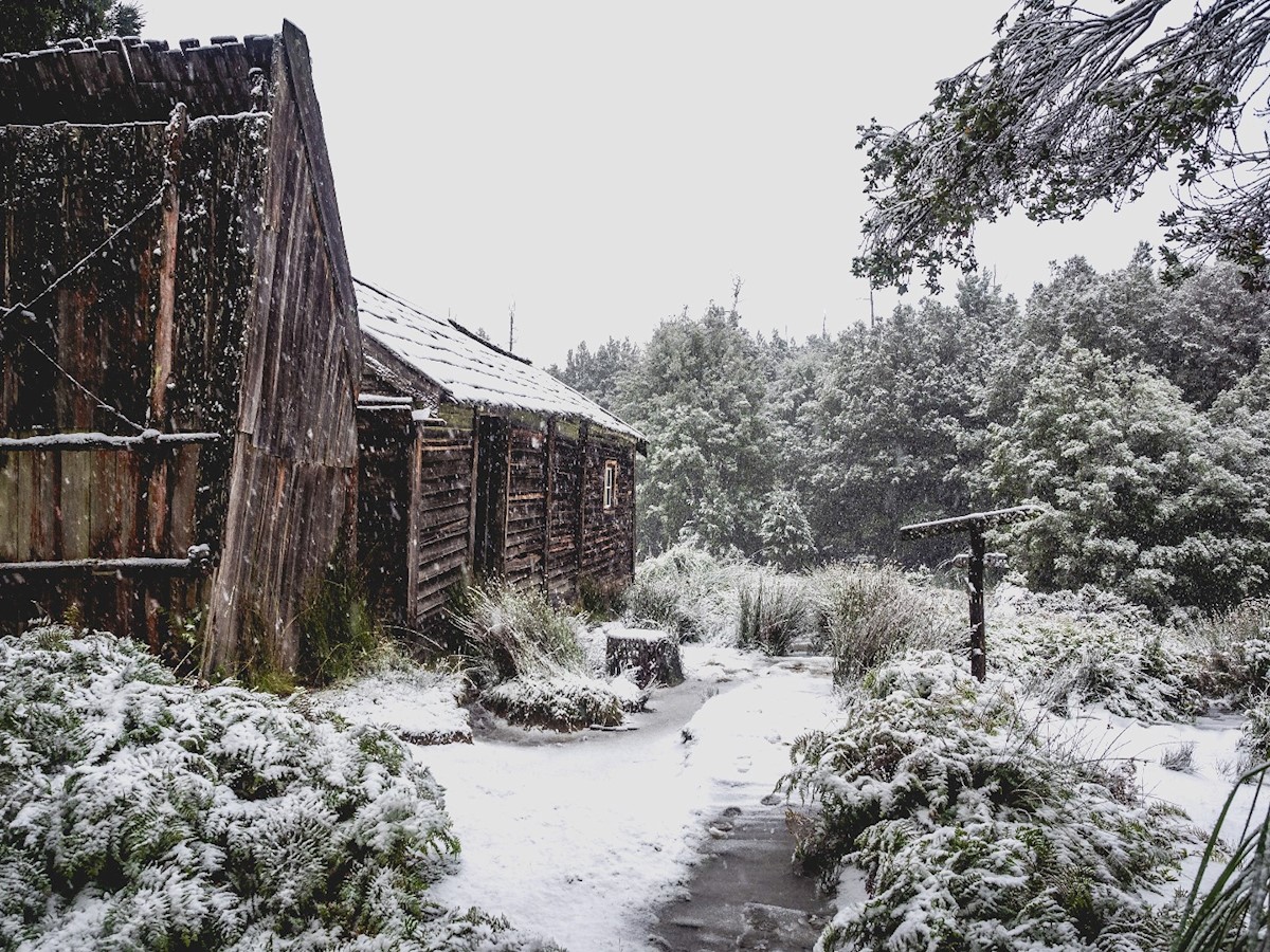
After an hour of walking I reached Du Cane Hut, which is an old hut reserved for emergencies only, but proved a great photo opportunity. A little further on is the turn off for D’Alton and Fergusson Falls. Be warned: the track down is very steep and quite slippery in wet conditions, so I really had to take my time, but the view was really worth it. The camera didn't make it out much because of the weather, but photos would've done these thundering giants justice anyway.
Back on the main track, I made the ascent to Du Cane Gap – the saddle between two mountain ranges. By this time the wind was really up, and snow was coming down heavy. After shuffling through during lapses in the wind, and waiting in the lee of the trees for the worse bits, I made it down to Bert Nichols/Windy Ridge hut for a much welcome lunch and change out of wet, icy clothes.
Windy Ridge to Narcissus
Distance 9km
Time 3-4 hours
Terrain Gradual, easy decent to Narcissus through eucalypt forest and across buttongrass plains.
This last afternoon of walking was a gentle finish to the trek. No more hills, but lots more mud. By this point I learned that there's not a lot of point going around it- it's quicker to go through, and your boots will be wet regardless.
Lake St Clair greeted one very weary walker with a beautiful sunset, and I settled in for the last night on the track feeling bittersweet - happy that there was no more walking, but melancholy that I'd be leaving such a beautiful place. Coming back into reception range to 80 something notifications made me realise just how nice it had been to have a communications detox.
Thanks for the memories, Tasmania. I'll be back.